The problem
Open SAR imagery may be technically available, but availability alone does not make it decision-ready. A useful comparison depends on acquisition geometry, timing, polarization, resolution, overlap, processing choices, and data quality. Even when those conditions are documented, an image difference is not automatically evidence of damage, cause, identity, intent, or operational status.
What I built
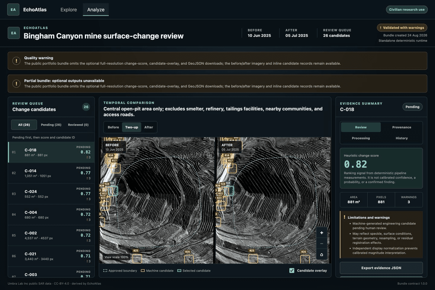
I defined and approved the product scope, civilian-use boundary, demonstration story, interaction direction, architecture, and release decisions. I directed and reviewed agent-assisted implementation across deterministic geospatial processing, FastAPI services, the React workbench, accessibility, testing, packaging, and delivery. EchoAtlas now connects provider metadata discovery, immutable pair review, a checksum-verified local raster pipeline, versioned evidence bundles, and machine-generated review candidates while keeping human judgment and interpretation limits explicit. Scientific validity remains undetermined.